

20.10.2026
Kargıcak or Demirtaş: which Alanya area to choose for living and buying
Choosing a property

Search

A practical route around Iotape on the Alanya-Gazipaşa road and ideas for separate trips to Selinus and Antiochia ad Cragum: timing, the climb, the sea and the checks to make before you set off.
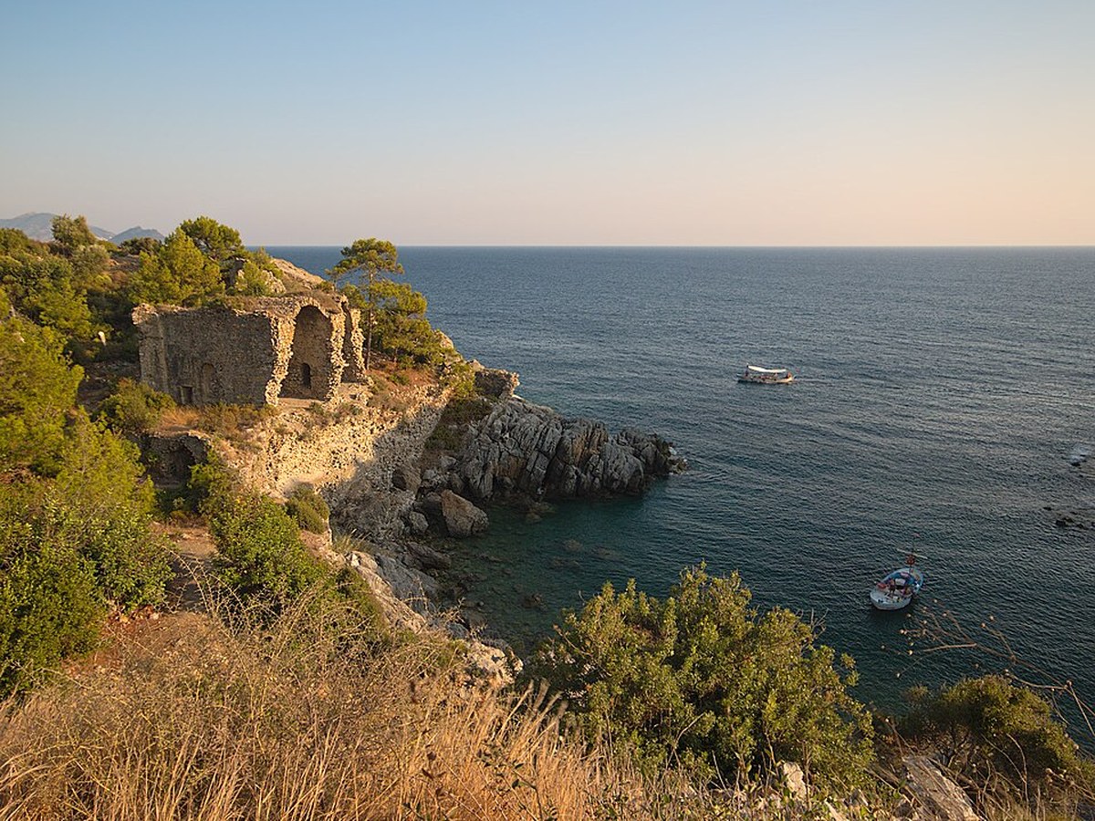
The eastern coast between Alanya and Gazipaşa is interesting for more than its beaches and mountain roads. Ancient cities have survived here, woven into the modern landscape. The most accessible for a first visit is Iotape, where the ruins, small coves and the main road sit practically side by side.
But being so close to the highway calls for caution. This is not a city museum with a single entrance and a level path: before you stop, assess the traffic, parking, terrain and weather.
Iotape lies at the 33rd kilometre of the Alanya-Gazipaşa road. The ancient city occupied a coastal headland and the land on both sides of today's highway.
The acropolis stands on the high ground, and an ancient harbour street runs along its base. In the eastern part, official sources note the remains of a bath, a temple and a basilica. The necropolis lies north of the modern road.
This layout helps you see how the city was tied to the sea, but it also creates a practical limitation: you cannot plan to cross between the parts without first assessing the traffic.
For a first unhurried visit, allow about one and a half to two hours, not counting the journey. If you climb to the acropolis, take photos and read the information boards carefully, you will need more time.
Do not combine Iotape, Selinus and Antiochia ad Cragum into one compulsory route. On the map they belong to the same direction, but each site requires its own drive, parking and separate visit.
The official description warns that the climb to the acropolis is difficult. You will need shoes with a firm sole, water and sun protection. After rain, the stone and ground can be slippery.
With a child or with limited mobility, it is wiser to focus on the accessible lower areas and the view, rather than making the climb a must.
Its coastal setting makes Iotape especially photogenic. However, whether you can swim depends on the waves, the wind, the entry into the water and any current local restrictions. The archaeological remains must not be used as a place to jump from or as a support when climbing down.
Selinus lies where the Hacı Musa river reaches the Mediterranean. Its area includes coastal and hillside sections, and the officially described remains include walls, an agora, baths, a necropolis and an odeon.
It is a logical next step in getting to know the eastern coast, especially together with Gazipaşa, but it is not a quick extra stop after a full visit to Iotape.
Antiochia ad Cragum is located in the Güneyköy area. The city sits high above the sea, and its parts are spread over several hills. Here you can see a colonnaded street, an agora, a bath, a triumphal arch, a church, a necropolis and medieval fortifications.
This route requires more time and physical fitness. The cove below the ancient city should not be presented as an automatically safe place to swim.
The road to Iotape shows the scale of the eastern direction well: the districts of Alanya gradually give way to a less built-up coast, mountains and the road to Gazipaşa. When choosing property, this is more useful than an abstract distance, because you see the real traffic, the terrain and how the settlements are connected.
SIPWALL Estate helps you assess a property in the context of these everyday and weekend routes: where the road runs, how long the journey takes and whether a specific address suits your way of life.
If you are planning another trip east of Alanya, see also our guide Sapadere Canyon: route from Alanya, getting there and tips before you go.
Looking for an apartment in Alanya that fits your lifestyle? Message us via the Telegram bot or WhatsApp, phone +90 551 507 90 67.
Photo: Iotape-06-2 by Stegop, licensed under CC BY-SA 4.0, cropped and resized.
20.10.2026
Choosing a property
16.10.2026
Choosing a property
12.10.2026
Choosing a property
09.10.2026
Choosing a property
06.10.2026
Choosing a property
02.10.2026
Choosing a property
Enter your budget and phone — we'll send you a selection with current prices.